
The easiest to use Google maps plugin! Create a custom Google map, map block, store locator or map widget with high quality markers containing categor …
OS DataHub Maps
Hospedagem WordPress com plugin OS DataHub Maps
Onde hospedar o plugin OS DataHub Maps?
Este plugin pode ser hospedado em qualquer hospedagem que tenha WordPress configurado. Recomendamos escolher uma empresa de hospedagem confiável, com servidores especializados para WordPress, como o serviço de hospedagem da MCO2.
Hospedando o plugin OS DataHub Maps em uma empresa de hospedagem seguro
A MCO2, além de configurar e instalar o WordPress na versão mais atual para seus clientes, oferece o WP SafePress, um mecanismo exclusivo que assegura e aumenta a performance do seu site simultaneamente.
Por que a Hospedagem WordPress funciona melhor na MCO2?
A Hospedagem WordPress funciona melhor pois a MCO2 possui servidores otimizados para WordPress. A instalação de WordPress é diferente de uma instalação trivial, pois habilita imediatamente recursos como otimização automática de imagens e fotos, proteção da página de login, bloqueio de atividades maliciosas diretamente no firewall, cache avançado e HTTPS ativado por padrão. São plugins que potencializam seu WordPress para a máxima segurança e o máximo desempenho.
This plugin allows maps to be inserted into a page or post using the new Ordnance Survey Data Hub platform which launched in 2020. It displays UK Ordnance Survey maps with their legendary level of topographical detail, making them ideal for walking, cycling, riding, and just about anything outdoors-related. You can add routes from GPX files, elevation profiles, and markers for points of interest.
The plugin takes over where the previous plugin, OS OpenSpace Maps, left off. Using the new OS Data Hub and its suite of APIs, you now have access to the full 1:25,000 Explorer mapping as well as the 1:50,000 Landranger series. And the free allowances are a lot more generous, offering typically 2,000,000 map views per month.
This plugin uses Leaflet.js to display the maps, giving a clean interface and a responsive feel with easy zoom control, full screen view and even printing. Insert the [osmap] shortcode anywhere in your post, page or custom post type content to display a map.
The map is set up using shortcode attributes, and there are now more of these than can be described in this Readme file. For full details, please check the plugin homepage.
Additional Shortcodes
Display one of the marker icons inline with your text using [osmap_marker color=red]. This may be used to add annotation to your maps.
Use [osmap_link marker=1 zoom=8] in conjunction with marker_link=link attribute to embedded a link within text on the page. When clicked, the map will be scrolled into view, zoomed onto the marker position and the marker opened.
Examples
-
[osmap]displays a map at the default height and zoom level, centred on OS headquarters in Southampton. This is the simplest way to test that the plugin is working. -
[osmap height="300" width="300" color="blue" gpx="http://www.example.co.uk/myfile.gpx"]displays a 300px by 300px window containing a blue track from the file specified. -
[osmap markers="NY2000008000;Wasdale"]shows a default size and zoom window with a marker placed and the popup text “Wasdale”
Migration from OS OpenSpace Maps
Ordnance Survey has now shut down the OpenSpace Maps service. This plugin aims to give a seamless upgrade to use the new Data Hub Maps service instead. It uses the same shortcode and all the same attributes are supported.
The Data Hub service is a significant upgrade from OpenSpace, allowing use of the excellent 1:25,000 Explorer mapping. It also has a much more generous free data allowance, typically 2 million map views per month.
The plugin itself is also a major upgrade, with many more features than the original OpenSpace plugin.
Capturas de tela
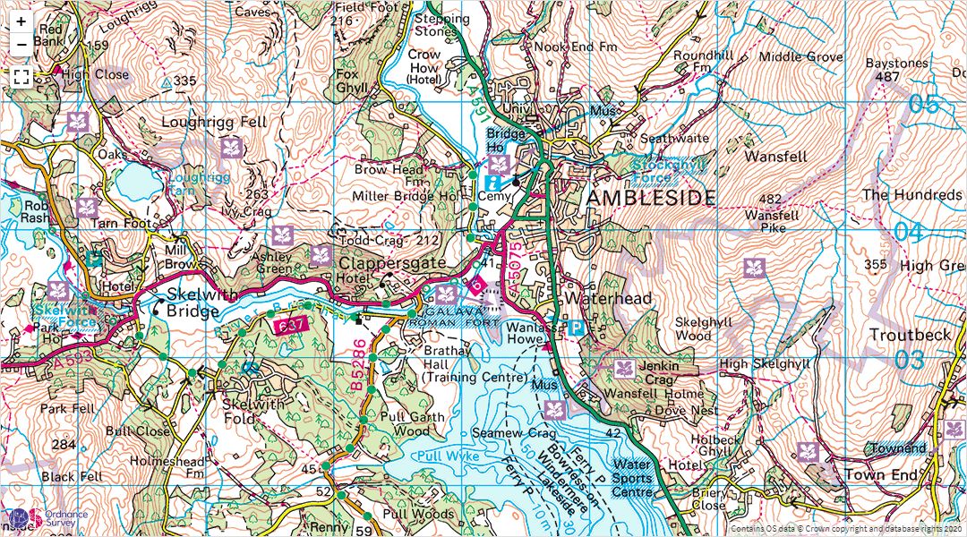
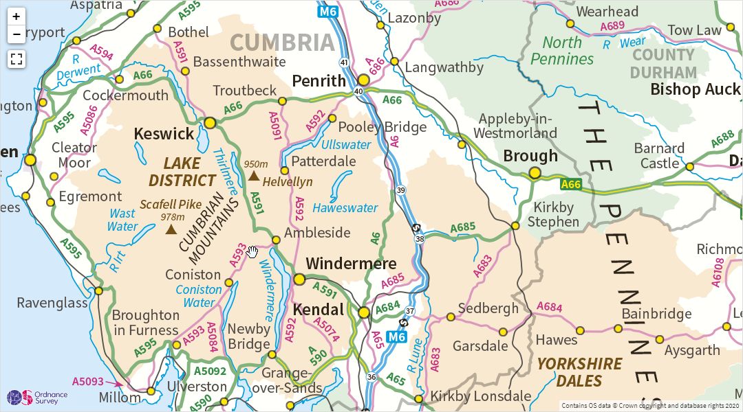
A 1:50,000 Landranger map embedded in a WordPress post
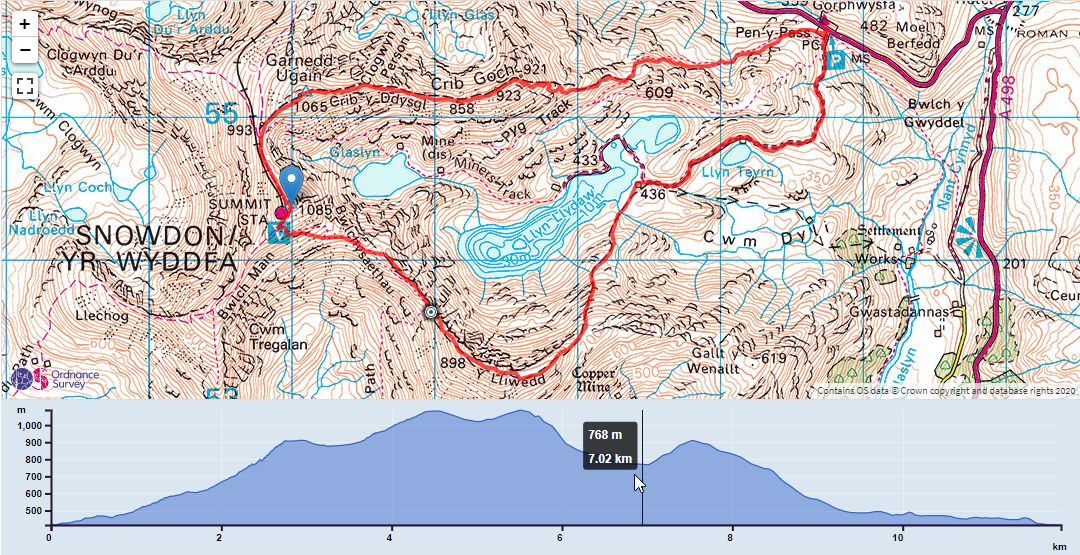
A map showing a GPX track and elevation profile
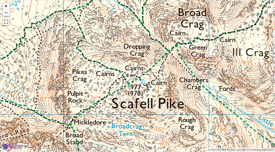
A 1:25,000 Explorer map
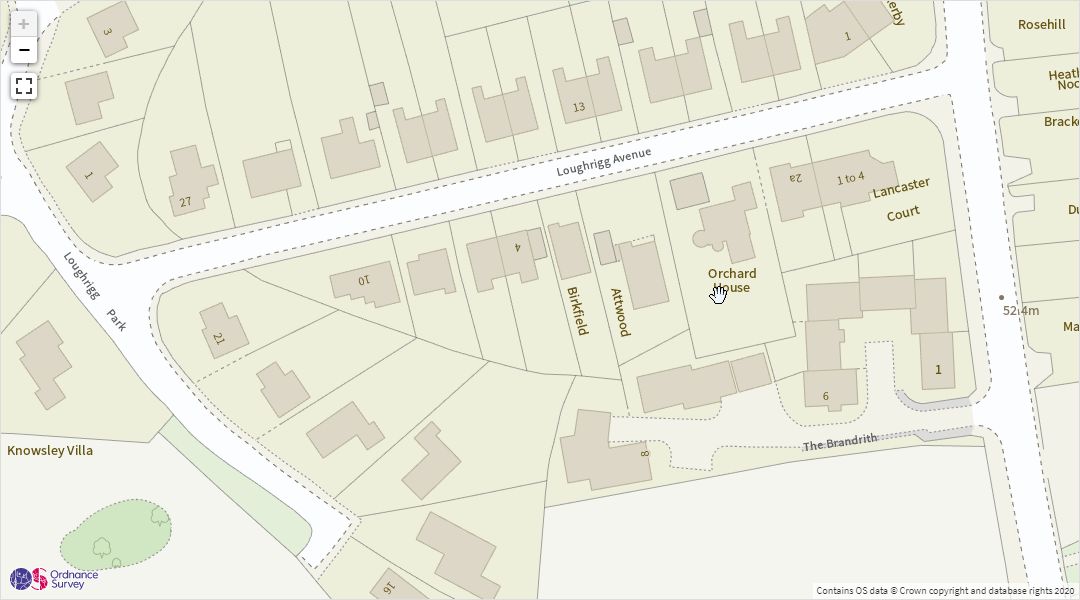
Highly detailed street-level views are also available
Zoomed out to 1:1M scale
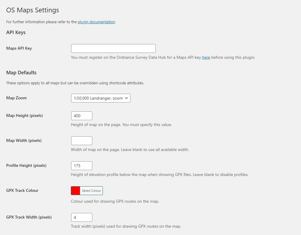
The defaults settings page
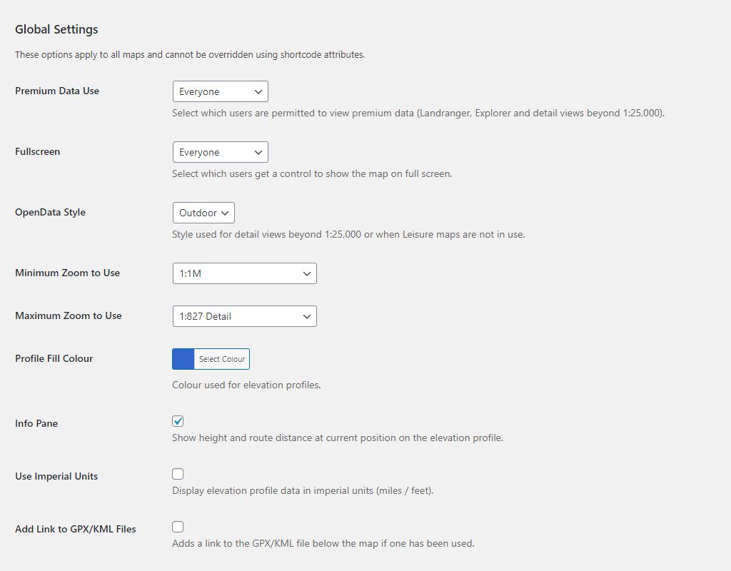
The global settings page
Plugins semelhantes
WordPress map plugin for Google Maps, OpenStreetMap & Mapbox with store locator, filterable listings & custom markers.
Are your Google Maps slow? Try Map Widget for Google Maps. You'll have a fast Google Maps widget with a thumbnail & lightbox map in minutes!
Crie mapas vetoriais interativos do mundo, continentes, qualquer país do mundo e regiões específicas, incluindo mapas individuais de condados dos Estados Unidos.
Google Maps with markers, locations and clusterization, KML layers and filters. Custom Google map markers with text, images, videos, links.
Google Map plugin for WordPress is very Simple, light-weight and Easy to use Google Custom Map with markers in Posts, Pages, Sidebar as shortcode.